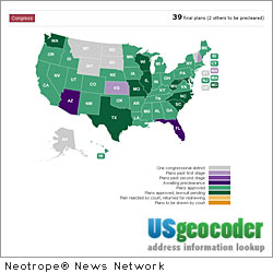
"Based on 2010 census data, states are redistricting jurisdiction boundaries," says Mitchell Pearce, CEO of Online Image. "Redistricting has reshaped the U.S. political landscape. Districts are gaining and losing addresses. As the 2012 elections approach, our redistricted congressional and state legislative district products and services ensure accurate district-to-address matching that is mission critical for political and advocacy campaigns."
The new district data products and services are generated by www.USgeocoder.com – the flagship product of Online Image. USgeocoder is a Geographic Information System (GIS) that uses proprietary algorithms to cross-walk various databases and generate the most accurate jurisdictions. USgeocoder is the only service that achieves greater than 99 percent accuracy even when no publicly available map exists for an address.
Online Image has been closely monitoring the redistricting process in each state. USgeocoder integrates the state's new district definitions with precise GIS data and the latest postal data to produce new district information. It updates its data files as often as the states and USPS update their files.
Online Image makes the new congressional and state legislative district data available by 9 digit zip code, address range, shape file, and Census Block Assignment File. USgeocoder can use this data to match existing large address files to new districts and show new districts with custom address data on maps. Voter registration data can be appended to addresses and the maps to create precinct canvassing routes, call lists, and email lists.
Online Image can also convert phone lists to address lists and then batch process them to match to any representative district all the way down to municipal and school board districts.
For more about the new district data products and services, visit http://usgeocoder.com/datafiles_overview .
About Online Image:
Based in San Jose, California, Online Image specializes in GIS data processing and mapping, advocacy management, custom web programming, and business management. Learn more at: http://www.OnlineImage.biz .
USgeocoder (www.USgeocoder.com), a wholly-owned subsidiary of Online Image, provides best-in-class affordable geocoding solutions for political district, mailing delivery; and census statistics data and mapping needs. It is a customized GIS application that serves political campaigns, lobbying and advocacy, government, sales tax compliance, and marketing organizations.
Copyright © 2012 CaliforniaNewswire® and Neotrope®. California Newswire is a publication of the Neotrope News Network and a U.S. reg. TM of Neotrope.


